|
November 02
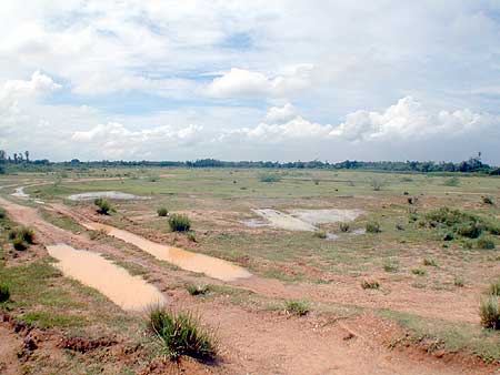
Doing a water resource study
Determining water availability
for the city
- in conversation
with Carel
"Is there enough
water for the city?"
This harrowing question was tabled in the Development Group about
six years ago. "None of us was able to give an answer beyond
'we should do a study', and hardly anybody had an idea about the
parameters," recounts Jan. "A water expert from New
Delhi was visiting Auroville at the time. He helped us to formulate
the Water Research Project and calculated the costs: about Rs
18 lakhs, way beyond the meagre budget of the Development Group.
We shelved the project, but the idea stayed very much alive. Friends
from the American Foundation for World Education (FWE) kept urging
us to start, but they too lacked the financial means to support
the project.
"It changed in
1999 when the Gateway group started its work of allocating a $
1 million donation to various Auroville projects. The Water Research
Project was dusted off and re-worked with the help of another
water expert, the Israeli Dr. Israel Gev, who was visiting Auroville
for a holiday. Then the FWE and Gateway agreed to co-sponsor the
project to an amount totalling Rs 15 lakhs. Dr. Gev had indicated
that Rs 15 lakhs would be sufficient for a study based on existing
data but that there would be no financial scope for drilling exploratory
bore wells or doing electro-resistivety or seismic tests to determine
the geological formations accurately. The Development Group nevertheless
decided to go ahead and appointed me as project manager. Three
experts, Dr. Chamanlal Gupta from Pondicherry, Harald Kraft from
Germany and Piero from Auroville, agreed to act as advisory team.
"The project started
in February 2000. The first thing to do was the delimitation of
acceptable boundaries for the research area. We finally agreed
on Kalliveli tank to the north, the ocean coast to the east, and
the Gingi river to the south and west. That determined a rather
big area of about 650 square kilometres.
"Then we started
the data collection, and almost immediately ran into a rather
solid wall. I thought that we could obtain data by just nicely
asking for them, but that proved to be an illusion. It started
with PASIC, the Pondicherry Agro Services Industrial Corporation,
which has drilled almost all the deep wells in Auroville. They
have reasonably detailed files on most wells they have drilled
in the last 10-15 years, including their depths, yields and qualitative
descriptions of the extracted drill material. The latter gives
an indication of the geological strata. But it took a year of
intense talks before they allowed us to make a complete copy of
all these files. Thanks to PASIC, we have now invaluable records
of 216 wells in Auroville's city, greenbelt and keyhole areas.
"Apart from PASIC,
we got well data from private drilling rigs and from the Sugar
Mills Department that had sunk wells in the northern part of the
research area. But none of their data were as complete as PASIC's.
We also approached the Central Ground Water Board. They have drilled
some test wells in the area, but until now they have not shared
their data. At present we are in the process of asking them to
allow us to monitor their wells.
"The next problem
was to create a base map. The maps that are publicly available
are on a scale 1: 250,000, which are unsuitable for our purpose.
But maps on a scale
1: 50,000 or 1: 25,000 are classified. Just when we had managed
to obtain copies of these maps, with the invaluable help of the
Secretary of the Auroville Foundation, we learned that an institute
in Bangalore (ISROE), which was doing similar work on a national
research level, had received official notice that they were forbidden
to use these maps for their work. We had to drop the idea, and
there was no other option than to use a Global Positioning System.
(GPS)
"This sounded easy
enough. We subcontracted this work to the Pondicherry based organization
FERAL (Foundation for Ecological Research Advocacy and Learning)
but they ran into unexpected difficulties. GPS is achieved through
Satellite Positioning, but due to Auroville's close proximity
to the Equator (and most GPS satellites are in the Northern Hemisphere),
more often than not the satellites were too close to the horizon.
In consequences, half of the coordinates lacked sufficient accuracy
and needed re-surveying. Then the GPS equipment broke down. What
should have taken three months again took over a year.
"Nevertheless,
what resulted is the most valuable result of the water study so
far: a base map as an accurate reference. It was overlaid with
a grid satellite image and shows not only road patterns, the true
extent of the surrounding villages, Auroville settlements and
even big trees, but also the land use patterns of the area such
as mixed forests, sugar cane plantations, peanut fields and cashew
topes which is very relevant for the project - and of course all
the wells, referenced in x/y/z coordinates. When we superimpose
the results of the Auroville land surveys on this map, there is
a complete picture.
"Auroville's unit
Water Harvest and Pondicherry and Tamil Nadu Government Departments
provided us with meteorological data. Interestingly, some of the
oldest data came from Auroville itself, recorded in the small
meteorological station set up in Certitude in 1969 by Chamanlal
Gupta. It operated for a number of years, measuring temperature,
sun-intensity, relative humidity, wind speed and rainfall.
"In all, it took
two years for data collection and the creation of a base map instead
of six months as projected. So we are way behind schedule. But
with what is available today, we can go for the next step."
That next step has meanwhile
been taken. It involves the Pondicherry Engineering College. Its
Department of Civil Engineering is scrutinizing the collected
data and has agreed to make the first "static model"
of the hydro-geological situation in the area. This model will
show the pre-monsoon, post-monsoon and dry season situation, and
will allow to a certain extent the prediction of the water availability.
But the big challenge
is to develop the "dynamic model" which could serve
as the basis for making long-term assessments of water availability
and could answer questions such as "what happens if the water
draft is increased by say 500%. and we get a succession of 2 dry
years?" Developing dynamic models is state-of-the-art in
the West where highly sophisticated programmers do computer simulation.
"In India there is ISROE and there are Indian Institutes
of Technology (IIT's), but it may be difficult to get experts
with real experience," fears Jan. "Moreover, we need
to get the expertise and training ourselves so that over the years
the model can be improved and modified as per our needs and we
can run our own types of scenarios. But that's for the future."
|